On The Road Again; Portland to John Day and the Chief Joseph Rally

IMG_3847 (2)

A yearly event since the 1970s for the BMW Riders Of Oregon is the Chief Joseph Rally.  The first several years the rally was held in Joseph, Oregon, named for the famous Nez Perce Chief (Nez Perce call themselves Niimiipuu).  It is now held in John Day, Oregon.

DSC_6862

We pulled out of Portland, Oregon around 0930 for the 270 mile ride.  We chose to ride Highway 26 the entire day, which takes you over Mt. Hood and the Wapanitia Pass at Government Camp, across the high plains desert, and through the Warm Springs Indian Reservation.  We stopped for lunch in Madras.

images

The prettiest part of the ride was from Prineville, Oregon, through the Ochoco National Forest, and into John Day.

Ochoco rest stop

Ochoco rest stop signs

DSC_6882

Hwy 26 near Mitchell

John Day map

We rode through Picture Gorge, just past the Highway 19 turn off on 26 and continued eastbound through Dayville and Mt. Vernon into John Day.  This part of the ride is mostly farm land, dotted with old barns and surrounded by dry hills.

John Day 36 miles


picture gorge

red barn

DSC_7000

barn 3

barn 2

Many of the rally participants camp, but we rented a beautiful house through AirB&B on a hill overlooking the small town of John Day.  We pulled into our rental house around 5:30 pm.

DSC_6907

IMG_3830 (2)

IMG_3834 (2)

Posted in Cars & motorcycles, Oregon, U.S.A. | 4 Comments

Things To Do In And Around Portland

IMG_3720 (1)

The Great Northwest is second only to Sweden in places I want to be during Midsummer. I am in Portland now, enjoying long summer days and pleasant temperatures.

There are many things to do in Portland, as I’ve written about previously, but this time I had the good luck of being in Portland during the Portland Art Museum’s special exhibit The Shape of Speed.

As a Father’s Day treat, we attended with my father on a beautiful Sunday.

The Portland Art Museum special exhibit is The Shape of Speed: Streamlined Automobiles and Motorcycles, 1930-1942, and runs through September 16th.

The exhibit features 19 rare streamlined cars and motorcycle, including a 1934 BMW R7 concept motorcycle.

DSC_6473

DSC_6623

My favorite car of the show was the 1938 Delahaye 135M Roadster.

DSC_6537

DSC_6572

The exhibit was well done, allowing photos and very close views.

https://portlandartmuseum.org/exhibitions/shape-of-speed/

DSC_6600

DSC_6586


DSC_6611

PARKS

Portland is known as The City of Roses and is famous for the Portland Rose Gardens. But that isn’t the only place to see the roses. In north Portland, Peninsula Park is a popular gathering place.

DSC_6374

DSC_6376

DSC_6389

DSC_6424

DSC_6408

Portland has many parks, and we enjoyed an early morning dog walk in Cathedral Park, under the St. Johns bridge, a Portland icon.

DSC_6431

DSC_6444

On a hot afternoon (it hit 87 F in Portland this particular afternoon) you can find cooler temperatures in Pier Park, where the trees are very tall. Fans of the NBC television show Grimm may recognize some of the park scenery. Many of the Grimm episodes were filmed in Pier Park in Portland’s St. Johns suburb.

DSC_6640

DSC_6630

DSC_6628

WINE TASTING

No trip to Portland would be complete, for me, without at least a quick foray into the Willamette Valley wine region, now home to hundreds of vineyards. Not technically Portland, some of the vineyards and tasting rooms are quite close.

My newest favorite tasting spot is David Hill Vineyards, very near Forest Grove, and just a short distance from Portland.  They encourage you to sip your favorite wine in the chairs surrounding the old farm house, repurposed as the tasting room.

DSC_6714

DSC_6701

DSC_6690

I quite enjoyed their Estate Pinot Noir Rose.

https://www.davidhillwinery.com/

DSC_6679

OREGON BEACHES

Another pleasant spot near Portland is Cannon Beach.  About a two hour drive, it is dog friendly, campfire approved, and you can even enjoy your favorite beverage right on the beach.  The Oregon beaches are the beaches of YES.   The Florida beaches, in contrast, are the beaches of NO;  no campfires, no dogs and no alcohol.  So grab your best friend and your favorite bottle of wine, and head west.

DSC_6757

DSC_6815

DSC_6807


Posted in Cars & motorcycles, Oregon, U.S.A. | 2 Comments

Last Days In Grenada

waves

Grenada is a tropical island, and it needs rain to be as lush and green as it is.  I got about a day and a half of rain, and it was nice.  Great time to use the spa.

raindrops

The wind picked up and the waves grew stronger.  No one swam in the ocean for a day or two and you could hear them crashing all night.

Laluna’s Spa:

spa

The Spa Lounge:

spa lounge

flowers

The Spa Rooms:

spa rooms

lily

Between the beach and spa building is the yoga pavilion.  Between the dining room and the yoga pavilion are the kitchen herb gardens.

yoga pavillion

garden

Eventually the rain ended and the sun came out again.

L at Laluna

lounge

The Conch I Found On The Beach:

conch

The Laluna Dining Room:

restaurant

dining room interior

Octopus Salad:

octopus salad

birthday cake

rainy sunset

This moon carving presides over the pool side bar and lounge.

moon man

And this odd coconut shell head man presides over the dining room.

Laluna man

This little guy shared my porch with me for several days.  He enjoyed scrambled eggs and eventually canned cat food after a quick trip to the local super market.  I would have loved to bring him home, but he seemed very happy with his current circumstances.

kitty

I highly recommend Laluna as a friendly, comfortable and relaxing place to stay when visiting Grenada.


Posted in Grenada | Leave a comment

Discovering Grenada

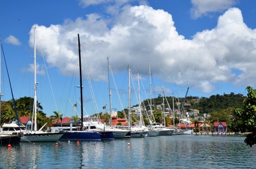
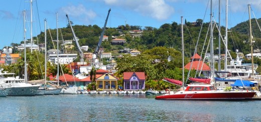
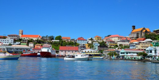
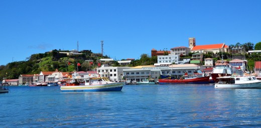
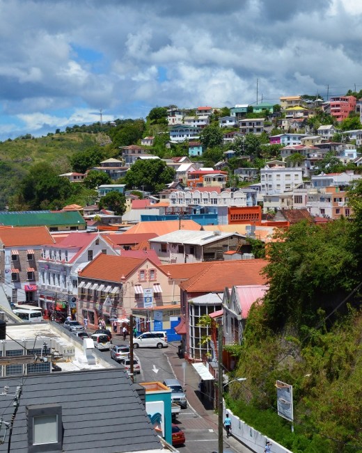
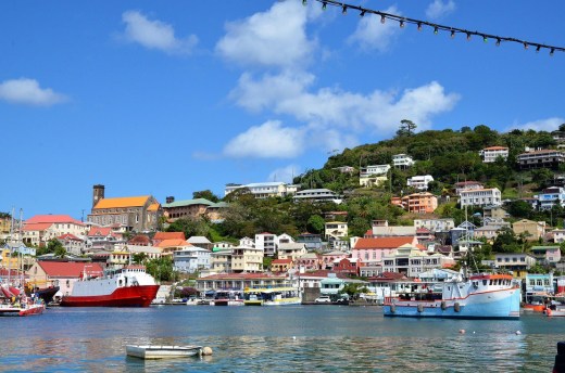
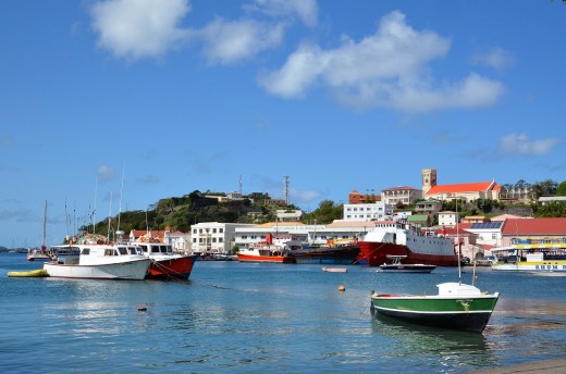
Driving around St. George’s, the Carenage:

Carenage

I had read about a good restaurant on the north side of the island, so with a rental car at my disposal, I spent Saturday driving along the west coast to explore the northern end of the island.

Carenage 2

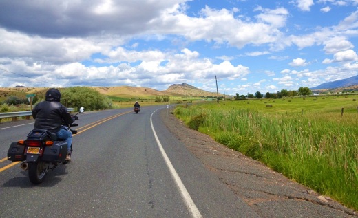
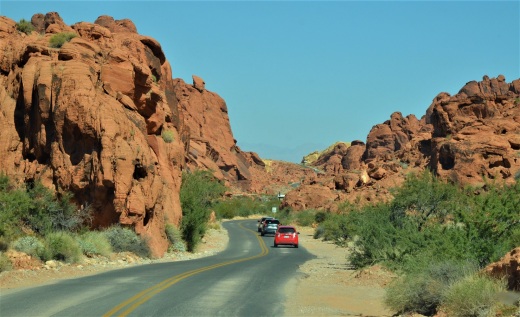
Driving through St. George’s Town was much easier Saturday morning compared to Friday.   What is depicted on the tourist map as the “main” road is a bit deceiving.  At times it could pass as a main road, if a narrow two lane semi-paved road without shoulders could be considered a main road, and at other times it was little more than a trail.   I headed north along the coast from St. George’s towards Sauteurs.

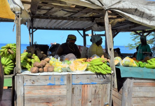
A vendor along the main road just north of St. George’s:

banana stand

This part of the drive was pretty good until reaching Gouyave.   The main road was impassable due to a washed out bridge.  Road signs were mostly nonexistent, but there was a hand written detour which I followed.  Only problem is that there was only one detour sign.  I turned around and went back, followed a different road, found a “Y” with a one way, so naturally took the one way in the direction I was traveling.  I ended up making a loop.  With frustration starting to rear its ugly head, I stopped and asked some mechanics how to get past the detour.  Everyone was very helpful, and it turns out I had to drive back to the “Y” and go down the one way in the wrong direction.   Finally past Gouyave, with help, which is a consistent plus here, I was back on the main road.  

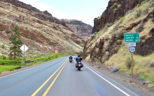
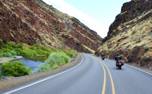
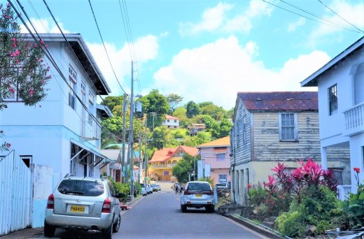
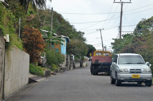
The main road somewhere on the west coast of Grenada, going through a small town:

street scene

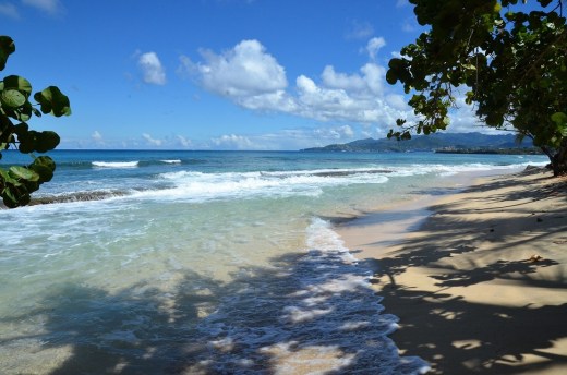
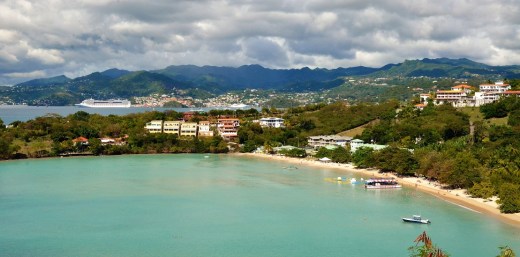
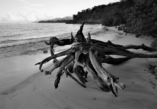
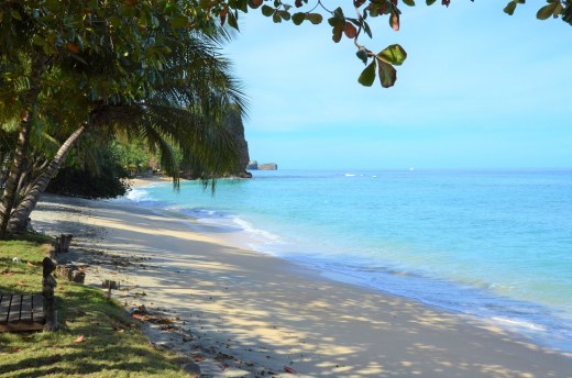
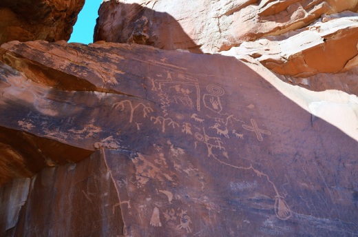
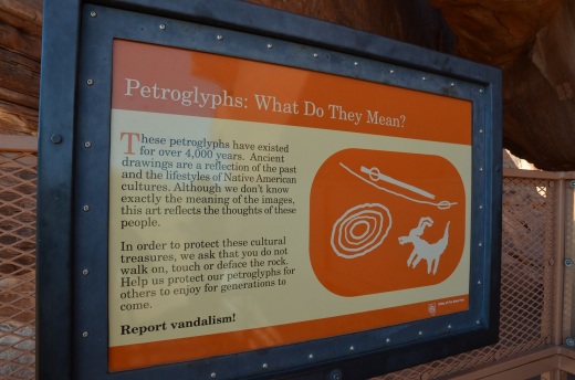
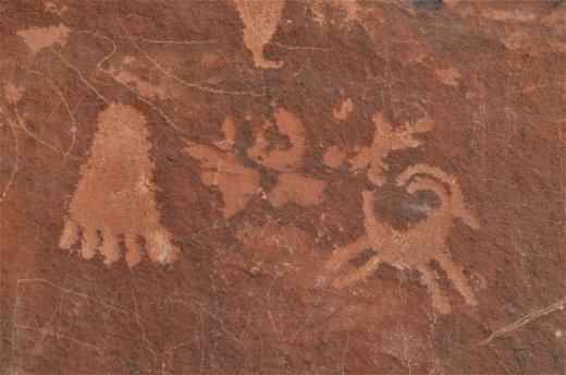
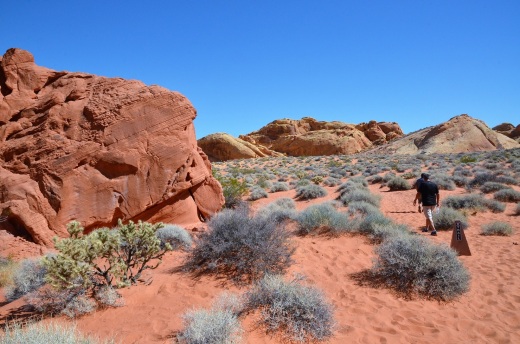
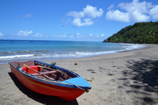
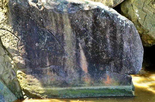
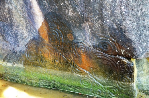
Where the road leaves the coast and heads into the hills is Duquesne Bay.  There are some petroglyphs in the stone near the beach which a little local boy came out to show me.  He was also helpful.  A break from the car was needed and I walked along the beach.

Duquesne bay

Grenada sign

petroglhyph sign

boat

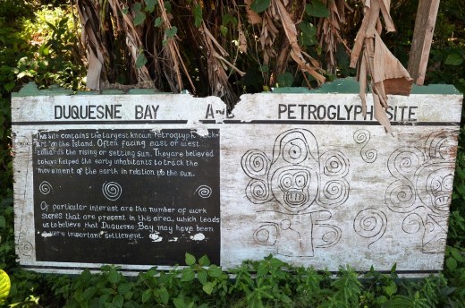
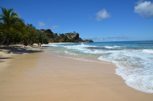
The petroglyph is in the lower right hand corner of the next photograph:

rock

petroglyphs

Unfortunately, a staple of all the islands I have visited are the starving, mangy dogs and goats staked by the road.  Grenada has them as well, and I had no food to hand out.
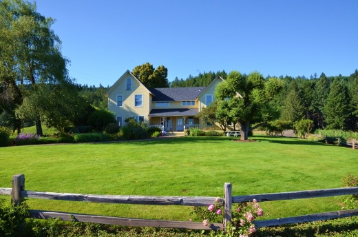
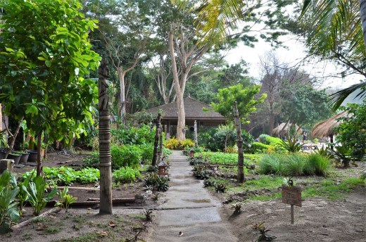
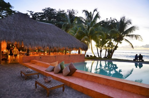
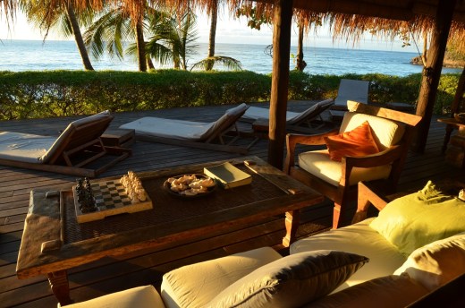
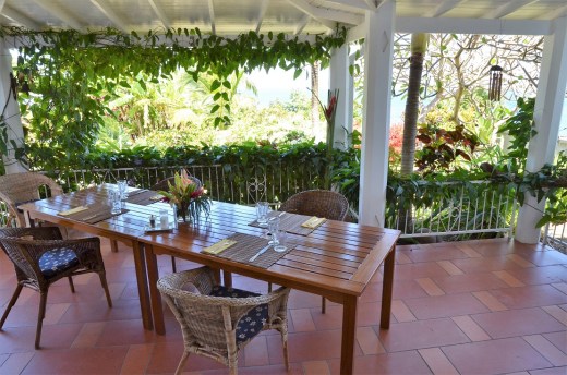
Armadillo’s Patio:

armadillo

The only way to know what town you are in is to ask someone.  The people who live here are very friendly and more than willing to help.  I stopped many times to ask directions and find out where I was.

St Vincent

tuna

lobster

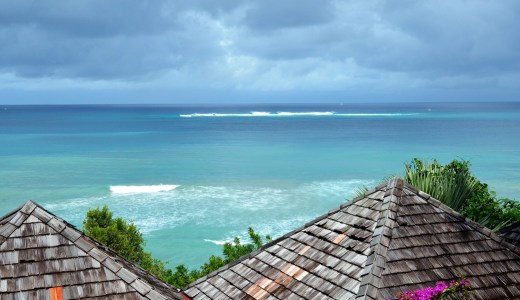
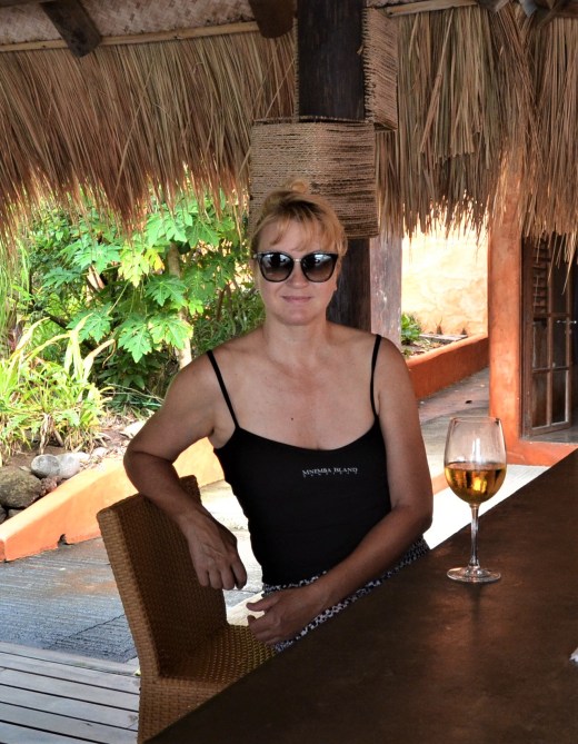
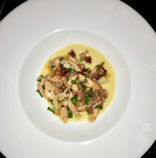
The restaurant I had read about is Armadillo.  On Trip Advisor it was the only one on Grenada with 5 stars from every visitor.  Andrea runs Armadillo, a guest house and restaurant.  You must pick your meal from the menu a day before and give an arrival time.  I had estimated my arrival at Armadillo to be between 1 and 2 pm, but made it around 12:30.

lily

banana plant

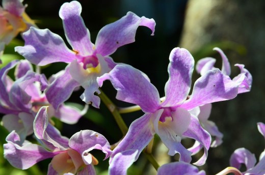
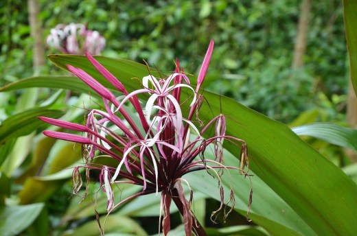
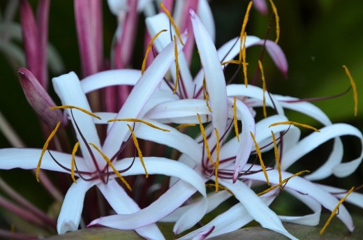
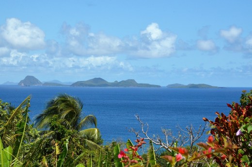
Armadillo is on top a hill on the north side of the island, just west of Sauteurs and has a stunning view.   The day I had lunch you could see as far north as St. Vincent.  There was a lovely breeze and lunch on her patio, surrounded by flowers, was wonderful.

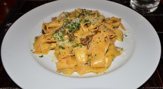
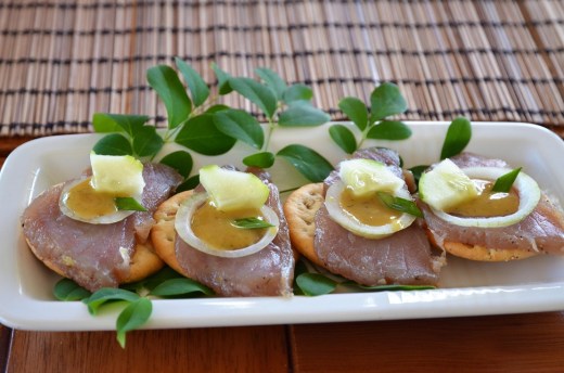
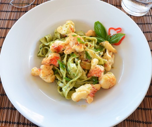
I had a tuna appetizer with onion and a mustard dill sauce, lobster with pasta, and almond chocolate mousse.  It was delightful.

I wanted to drive back a different route and completely avoid the detour is Gouyave, so I attempted to find the road heading south to Grenville.  The complete absence of road signs by now was no surprise, but still aggravating and made it nearly impossible to figure out exactly where I was.  I used general directions via the position of the sun and knowing I was on an island and could only get so lost, I continued.  There was no other option.

re

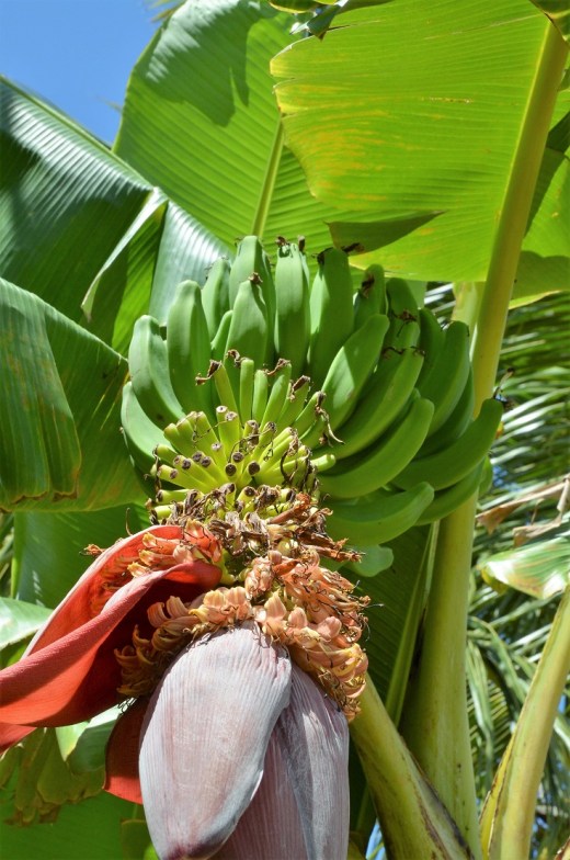
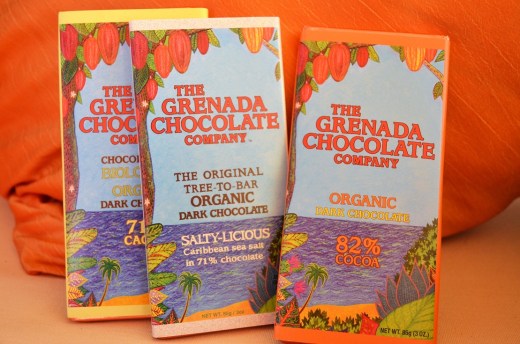
I was hoping to stop at the Belmont Estate Grenada Chocolate Company because it looked like I would drive right by it.   Again, no signs and I missed any sighting of the chocolate company.

choc

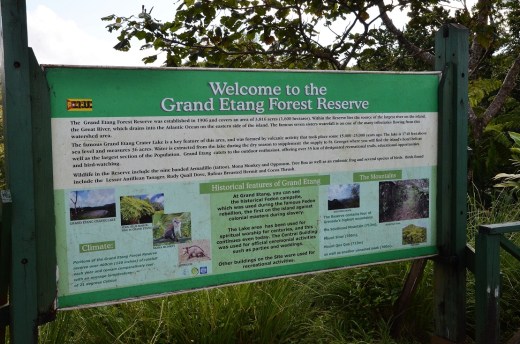
I finally made it to Grenville and headed west into the interior and the Grand Etang Forest Reserve.  The toughest and most treacherous part of the drive was between Grenville and Birch Grove, following what I can only guess was Road 6 (there were no signs), and up to the Grand Etang.  The road can best be described as nearly single lane with hairpin turns, steep drop-offs, no shoulder and on a fairly steep grade.  Many times I had to stop for oncoming cars, and at times even back up to a wide spot.  Pedestrians and other drivers were helpful and act as impromptu traffic cops waving cars along or signalling to slow down.

monkey sign

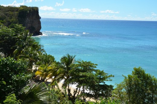
The steady climb into the rain forest afforded cooler temperatures, but no improvement in the road conditions.  At the top of the climb was the entrance to the Grand Etang Forest Reserve and a wide spot with a few smaller tourist buses.  I would not have wanted to either drive one of the buses up to the top, or meet one on the road.  From the reserve the road wound down into St. George’s, but it was not any wider until very near the bottom.  It would have been nice to tour the rain forest but the drive was exhausting and my only desire at that point was to get back to Laluna in one piece and relax.

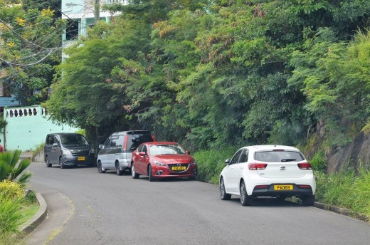
Typical street scene of the two lane main road with parked cars:

street 1

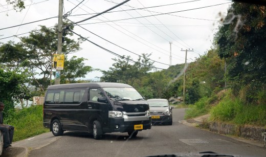
Buses do as they please:

street 2

Cars parked along a two lane main road with a blind corner. This is typical:

street 3

chicken plucker


Posted in Grenada | 1 Comment

St. George’s and local beaches

Magazine Beach:

magazine beach

A rental car was necessary to explore the area surrounding Laluna.   Picking up the rental at the airport, I discovered a Grenadian temporary driver’s license was required and easily acquired for an additional $24.  Who knew?  Just a stone’s throw from the airport and literally a 30 second drive, is the lovely Magazine Beach.

magazine beach 2

Locals vote this beach in the top two, due to the clear water and lack of seaweed.  My next stop was St. George’s, the main town and port city.  I found the roads on Grenada to be less well maintained than Barbados, being very narrow, and in need of pot hole repair.  The absence of street signs also was not helpful.

The Lagoon, coming into St. George’s from the south:

the lagoon

cottages and boats

There was quite a back up of traffic heading into St. George’s.  It was Friday, and the beginning of market weekend.  The streets were a bit confusing and quite congested.   Parking on the north side of town, outside the main area, was the only solution.

The habor, with Ft. George in the background on the left in the lower photo:

The Carenage

Ft George

The cruise ship port area was crowded.   I walked to Ft George for the view and through the spice market.  It was set up for the cruise ship passengers.  Having enjoyed nutmeg syrup at breakfast, it was the one item I purchased at the spice market.  The spice market was heavily scented with pot, not surprising, due to the local gentlemen puffing away on stogie sized joints.    I later asked a Laluna employee about the legality of pot, and he said in the market the smoking of joints was accepted, and even shared by the local police force, as long as you didn’t try to move more than a few pounds of the commodity.

Bruce street

The fish market close to the port:

fish market

There was so much traffic and it was so crowded, my only desire was to get back in the rental car and find a quiet spot for lunch.   A glance at the town map showed you could bypass the downtown/port area by riding along the ridge line, which I did.

With my patience for traffic gone, I headed to Grand Anse Beach for lunch, just two beaches down from Laluna, where I’m staying.

Grand Anse Beach looking north

lizard

Grand Anse Beach is a popular beach and I found a nice spot for the local catch of Swordfish.  It was quite good.

Morne Rouge beach looking north.  You can see St. George’s in the distance and the cruise ship port.

Morne rouge beach

One beach south of Grand Anse Beach is Morne Rouge Beach, and one more beach south of that is Portici beach where Laluna is located.

Portici Beach, where Laluna is located:

Portici beach

I was happy to return to the relative calm and quiet of Laluna.

lily

Luckily, Laluna’s restaurant is truly stellar for pasta.   I had one of the best pasta meals ever here, Pappardelle Laluna with nutmeg and porcini mushroom cream sauce.  I would highly recommend it.

pasta

LaLuna restaurant

mask

drift wood

tree

tree 2

t

Posted in Grenada | 1 Comment

Grenada

pool

I just arrived in Grenada, the Spice Island.   Just 3 1/2 hours nonstop from Miami, it is a new island for me.  I’m staying at the lovely boutique hotel LaLuna.

beach

The water is warm, I’m guessing 80 – 82 F.

beach bungalow


porch

bungalow interior

open air bathroom

loung chairs

Laluna beach

lounge

Laluna dining

porch colors

pool deck

looking west

sunset wave

happy hour

pool sunset

sunset

Posted in Grenada | 2 Comments

It’s Winter Solstice Time Again

Stonehenge in the snow (Pic: Reuters)

This Thursday, December 21st, we in the Northern Hemisphere will once again experience the Winter Solstice, an event celebrated by pagans for thousands of years.  After the solstice, the days will grow longer and the nights shorter, in the never ending cycle of seasons, nature, and the rebirth and awakening of the Spring after the Winter.

In order to compete with the pagan parties, Christians stole the Winter Solstice for their own, although Christ’s Mass was supposed to be a bit more subdued than the feasting and bonfires of the pagans.  It was Pope Julius I, in the 4th century, who declared that the birth of Jesus would be celebrated on December 25th.  Origen Adimantius was a third century biblical scholar and philosopher (possibly a religious fanatic as well.)  The following excerpt is from the website Christianity Today:

The eventual choice of December 25, made perhaps as early as 273, reflects a convergence of Origen’s concern about pagan gods and the church’s identification of God’s son with the celestial sun. December 25 already hosted two other related festivals: natalis solis invicti (the Roman “birth of the unconquered sun”), and the birthday of Mithras, the Iranian “Sun of Righteousness” whose worship was popular with Roman soldiers. The winter solstice, another celebration of the sun, fell just a few days earlier. Seeing that pagans were already exalting deities with some parallels to the true deity, church leaders decided to commandeer the date and introduce a new festival.

And for another take on the Winter Solstice, the following article was printed in The New York Times, yesterday, Sunday December 17th.   It was written by Mark Vanhoenacker, a fellow pilot.

At the Solstice, in Praise of Darkness

 For the roughly 90 percent of us who live in the Northern Hemisphere, the winter solstice of 2017 is coming soon (at 11:28 a.m. E.S.T. on Thursday, to be precise). And if it wasn’t so dark out, you’d see how happy I am that the year’s longest night is sweeping down over the northern half of our planet, as naturally as the lid of a closing eye.

Full disclosure: I’ve always loved the dark. My mother often recalled that as a small child I would sometimes grumble, “I don’t want the sun to shine, I want the moon to shine.” I decided to become an airline pilot in part because I believed that aviators might enjoy a particularly pure experience of night. The glow of the Christmas rituals I still love best — lights, candles, hearths — would mean little to me without the shadows that embower them.

To this dark but cozy and star-spangled corner of the calendar, I welcome like-minded pilots and air travelers; astronomers, of course; and any fans of “The Simpsons” who secretly cheered when Mr. Burns (“I call this enemy … the sun!”) tried to block out the light from everyone’s favorite ball of plasma. But whatever your feelings about the longest night, the winter solstice — transcendent, yet precise; celestial, but very local — is worth pausing to savor.

Indeed, while I hope to spend every Christmas at home by the fire, this is also my favorite time of year to fly. Night flights are often smoother, and they are almost always more sublime. Raise your window blind and you may be the only person to ever see how the moonlight falls on an ephemeral, rolling Narnia of cloud, while on a clear evening a city far below you may look exactly as we might most beautifully imagine it — as a shorthand for civilization, written in light on the pages of a darkened Earth.

When you look up, familiar, crystalline winter ornaments like Orion and the Pleiades appear, while auroras may offer the sensation, sometimes for several hours, of sailing across a phosphorescent sea. To reclaim a phrase from “Game of Thrones” — a show, ahem, that hasn’t exactly burnished winter’s reputation — the night is long and full of wonders. In contrast, pilots may greet the sunrise in the cockpit with a matching glare, and an inevitable “Star Trek” joke — “shields up!” — as we reach for our Ray-Bans and a phalanx of swiveling sun visors.

Pilots have more reason than most to follow the annual comings and goings of darkness. But Earth’s annual light cycle can profoundly affect all our lives, even in cultures remade by electric lights.

A solstice is an opportunity to remember that this cycle is caused by the tilt of Earth’s axis, a reason-for-the-seasons angle so important that desktop globes (you still have one, right?) are built to lean at it. The December solstice, inaugurating winter in the Northern Hemisphere and summer in the Southern, occurs at the moment the North Pole is most tilted away from the sun. Nearing this solstice, the northern world’s days grow shorter, and sunlight lands at shallower angles — heating the hemisphere less, and casting December’s familiar long shadows across the snow.

When this cycle was first explained to me as a child, my teacher advised me to imagine the “leaning” Earth as it arcs through its annual orbit around the sun. (Even as an adult, I like to close my eyes and relish the wondrous fact that you and I are sitting on a tilted blue-and-white planet that’s sailing around a star.) But such illustrations, however useful, make it easy to overlook the loveliest aspect of this Thursday: that a solstice is in fact a moment of rest.

What stops at the December solstice is the sun’s apparent southward and night-lengthening (or night-shortening, in the Southern Hemisphere) march across the sky. The true meaning of “solstice” — indeed, the word’s Latin roots refer to the stilling of the sun — was made clear to me by George Greenstein, emeritus professor of astronomy at Amherst. From his home in Pelham, Mass., Professor Greenstein has a good view of the western horizon. He asked me to imagine a continuous movie composed of photographs that capture the position of the setting sun (the rising sun would work equally well) throughout the year.

In this movie — with a soundtrack by Max Richter or Ludovico Einaudi, I’m thinking — the setting sun would migrate back and forth between its southernmost and northernmost positions on the horizon. The sun would accelerate toward the middle of its journey (around spring and autumn, when the lengths of the day and the night change most quickly) and slow down toward the extremes. Once the sun reached an endpoint, it would at last come to rest — as it will on Thursday — before its motion reversed. Earth orbits the sun continuously, of course. But the sun’s apparent annual motion is more like the pendulum of a great clock, one that steadily counts off the planet’s years, and ours too.

The poet Annie Finch is the author of “Winter Solstice Chant” (“the edge of winter sky/leaning over us in icy stars.”). During a phone call from her home in Portland, Me., she pointed out how neatly the solstice accounts for late December’s rich spiritual bottleneck of festivities and traditions in so much of the ancient and modern world. However we may celebrate the return of light to our skies and lives, she continued, we might also wish to pause to honor the darkness that will give way to it: “If you don’t experience the darkness fully then you are not going to appreciate the light.” A pause, of course, is just what we’ll be given on Thursday.

Ms. Finch also pointed out that the winter solstice, traditionally a time of introspection, can be a moment of warmth for communities small and large. “Darkness,” she said, “brings people together.”

When I heard this, I thought of how Thursday’s solstice is closing out a hard year — Ms. Finch would rightly rebuke me if I called it a dark year — for many. I was reminded, too, of my mother, who died just before the winter solstice of 2006. Unlike me, my mother found no comfort in darkness (she didn’t like flying much either). But she loved the winter solstice because she knew it marked the light’s rebirth. It was a win-win for us, you might say, and I’m glad it’s coming around again to a world that needs every shared wonder.

Posted in Seasons & Holidays | Leave a comment

Las Vegas Neon

more neon

cowboy and street

cowboy

fremont street zipline

zip liners

costume

neon martini

D Casino dancers

Fremont east

neon pump

east Fremont

praying mantis

light show

fountain

Bellagio

Posted in U.S.A. | 1 Comment

The Real Wild Las Vegas

sign

Two friends and I drove out to the Valley of Fire State Park for a look at more wild Las Vegas.   The Valley of Fire is only 55 miles northeast of Las Vegas, but it seems a world away.

DSC_4580

DSC_4592

DSC_4591

DSC_4586

There are camping sites and hiking trails in the park.  We stopped to view the petroglyphs at Atlatl Rock, the petrified logs, and toured the Ranger Station.

DSC_4617

DSC_4614

DSC_4682

From the ranger station the road winds north through the red rocks.  We stopped to walk a short distance along Rainbow Vista trail.

road

DSC_4641

DSC_4647

DSC_4645

We were surprised to see a group of Desert Bighorn Sheep, the official Nevada state animal.  We saw just a few at first, then more.

first sheep

DSC_4723

We followed a few of the sheep through the red sand.  They were shy but not terribly afraid of people.

DSC_4706

3 sheep

sheep action

DSC_4719

Desert Bighorn Sheep

We saw most of the Desert Bighorn Sheep around the Fire Canyon Road.   Continuing northbound you reach the White Domes Area.  There is a 45 minute hike at the end of the road.  The only other wildlife we saw were Antelope Ground Squirrels.

FIRE CANYON ROAD

DSC_4708

antelope ground squirrel

Driving back out towards the ranger station we saw a group of young sheep.

DSC_4730

We entered at the west entrance, and departed the east entrance.  The last rock formation is Elephant Rock, near the east entrance.

elephant rock

welcome


Posted in U.S.A. | Leave a comment

More From Natural Vegas

grand-canyon-regional-map

The Grand Canyon National Park is in Arizona, with 277 miles of the Colorado River running right through it. The Colorado River runs roughly east to west through the park, from Lake Powell on the Utah/Arizona border, to Lake Mead in Nevada, and passes through the Hoover Dam on it’s way south through Nevada and then California.  The west end of the park, and the river, is bordered on the north by the National Park and on the south by the Hualapai Indian Reservation.  It is also a short helicopter ride from Las Vegas.

From the Hualapai website:

The Hualapai Tribe is a federally recognized Indian Tribe located in northwestern Arizona. “Hualapai” (pronounced Wal-lah-pie) means “People of the Tall Pines.” In 1883, an executive order established the Hualapai reservation.  The reservation encompasses about one million acres along 108 miles of the Grand Canyon and Colorado River.

My friend Mike and I took Papillon Helicopter’s tour of the Grand Canyon that included a short boat ride on the Colorado and a chance to venture out on the Skywalk.

https://www.papillon.com/

helicopters

The tour begins at the Boulder City airport.  The approximately thirty minute flight to the west end of the Grand Canyon passes by the Hoover Dam.  The landing zone near the river is on the south side, on the Hualapai Indian Reservation land.  The short boat ride on the river is operated by the reservation.

Hoover Dam

DSC_4463

DSC_4391

The helicopter dropped us near the river, in a pretty desolate looking area.

DSC_4446

DSC_4448

We had a short ride along the Colorado, with our Hualapai Indian boat operator.   The river is muddy, cool and swift.

Colorado River

boat guy

After the short boat ride, another helicopter touched down just long enough for us to climb aboard and take off for the vertical hop up to the top of the canyon.

DSC_4428

DSC_4408


Skywalk from below

Skywalk from below

At the top of the canyon, many helicopters and buses unload guests for the Skywalk experience.  A short van ride from the heliport and we were ushered into the Skywalk.

DSC_4480

DSC_4482

DSC_4534

The Skywalk is owned by the Hualapai.  It is very controlled.  The one thing that didn’t make me happy was the ban on cameras on the Skywalk.  They have photographers there and you can purchase photos, but you can’t take your own.

IMG_2587

IMG_2609

So we did the walk over the glass panels and it was pretty cool.   We found a spot on the outside where you can take your own photos.

IMG_1829

DSC_4508

DSC_4514

The best spot for pictures of the actual Skywalk, is from the restaurant in the building.

Skywalk

The following two photos are professional shots which you can purchase on a thumb drive along with the photos of yourself taken by the Skywalk photographers.

11 NEGATIVE REFLECTION

14 SNOW DAY

The experience was fast paced and had a bit of a circus feeling to it, due to the amount of people milling around at the heliports.  The views were nice and I had really wanted to see the Skywalk since it’s construction ten years ago.

https://www.grandcanyonwest.com/skywalk–eagle-point.htm

All in all it was a fun way to spend half a day outside of the Las Vegas Strip.  Papillon has quite a few tours to choose from.  We began our tour at around 10 am and were back by 2:30 or 3:00 with about 1 1/2 hours at the Skywalk.

DSC_4568

Posted in U.S.A. | 1 Comment